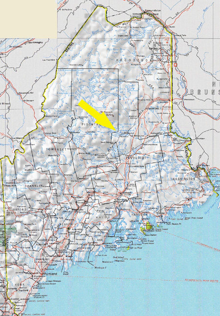
To download a high-resolution version of this map, click here. |
So where the heck is Millinocket, anyway? Well, if you're driving (fast), Millinocket
is about:- 90 minutes North of Bangor, ME
- 3 hours North of Rockland, ME
- 3.5 hours North of Portland, ME
- 5 hours North of Boston, MA
- 7.5
hours Northeast of Albany, NY
- 12.5 hours North of Sliver Spring, MD
- 15 hours North of Virgina Beach, VA
-
29
hours North of Naples, FL
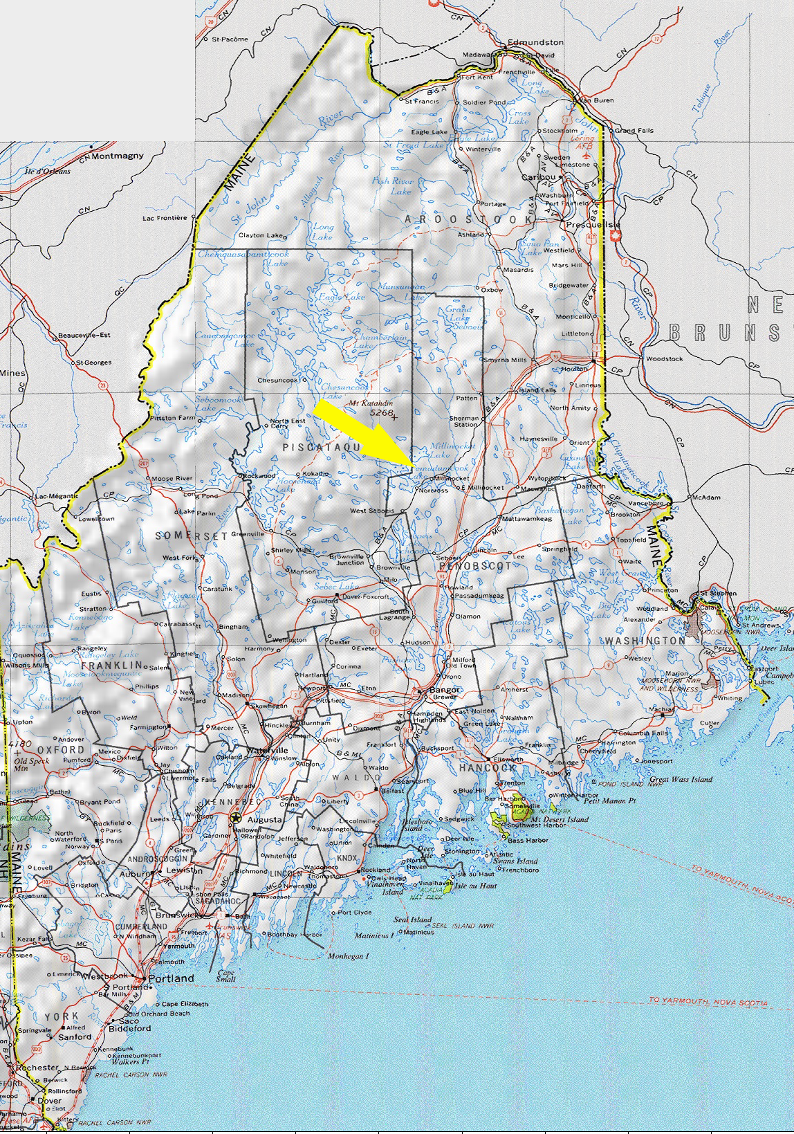
By Car
Just find Interstate 95 and head north! Take Exit 244 and turn
left onto route 11 / 157. Basically, just follow the signs for Baxter State Park. Go straight for the next 11.1 miles until you reach a traffic light in downtown Millinocket. Go straight through. A short distance away, bear right at a flashing light, then follow the signs to Baxter State Park and take your next left onto Bates St. / Millinocket Rd. Follow this road for the next 8.2 miles, and then keep an eye out for signs for Twin Pines Camps. If you get to the North Woods Trading Post, you've gone too far! There will be a dirt road on your right. Follow this road to the end. For a complete travel package of directions and maps from Bangor to the wedding site, click here:
Download driving directions. You'll need Adobe Acrobat Reader to view the downloaded maps... if you don't already have it installed on your PC, go here to get it: www.adobe.com.
By Plane
Bangor International (BGR) is the closest you can get on a commercial flight. Several major airlines service the airport. For more information regarding flights
and schedules, visit the airport's web site at www.flybangor.com, or any of the major carrier web sites. Of course, if you've got your own plane, feel free to fly right into Millinocket Regional
Airport!
|